Visiting Marojejy
Marojejy is well worth exploring. The entire area is easily accessed from Sambava, which has fairly reliable air service from Antananarivo, Antsiranana (Diégo-Suarez), Toamasina (Tamatave), and Maroantsetra. A paved road with beautiful scenic views winds for approximately 100 km (60 miles) up the Lokoho River valley from Sambava to Andapa. Taxi traffic between the two towns is frequent.
The park is open year-round, but the best time to visit is from October to mid-December when it is less rainy and the birds and animals are more active. The heavy rains that occur from late December through March can make travel difficult and even dangerous, with muddy, slippery trails and high water in river crossings.
Information, entry tickets, and guides and porters can all be obtained at the park visitor center located in the village of Manantenina (65 km from Sambava along the Sambava–Andapa road). Employing a local tour operator for your trip can be helpful for smoothing all the logistical details.
Marojejy currently operates three camps within the park, all with rustic cabins and sheltered eating areas, as well as areas where tents can be pitched. The park offers treks of varying lengths along a main trail that leads from the village of Manantenina into the rainforests of the park and eventually all the way up to the summit of Marojejy itself (elevation 2,132 m / 6,995 ft).
[Click or tap on named locations on map for information and a photo.]
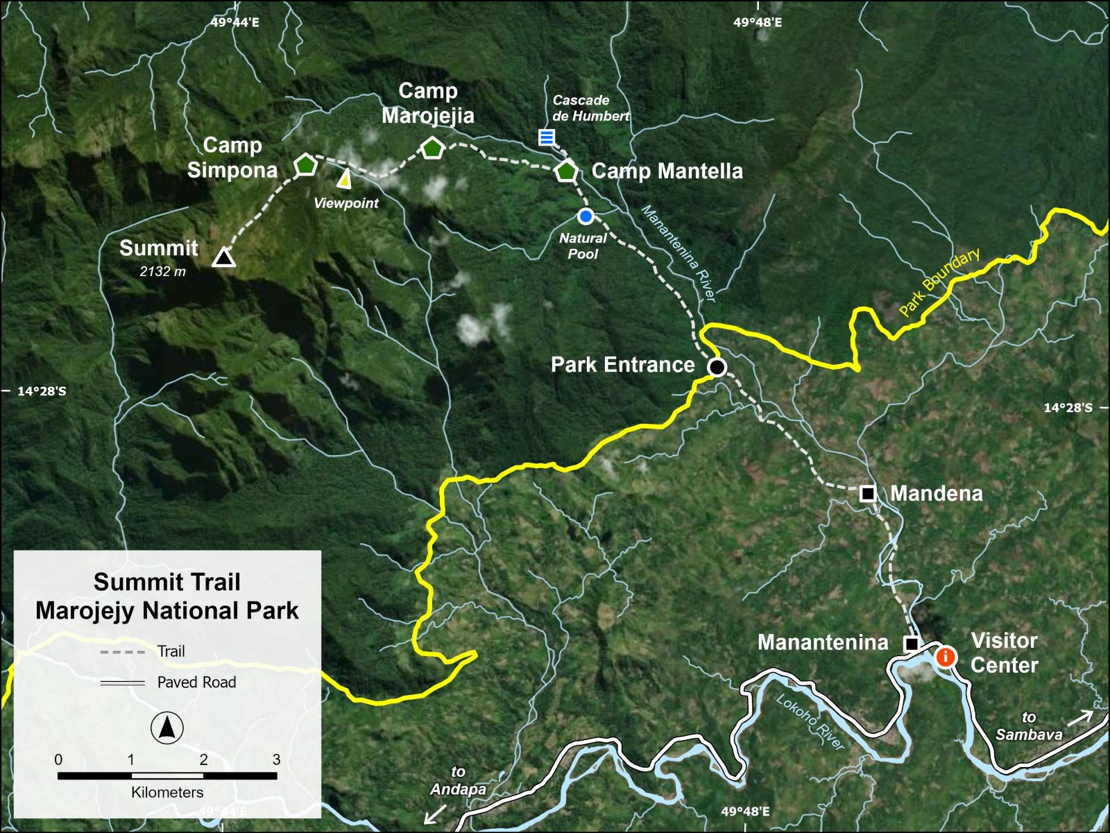
Marojejy Summit
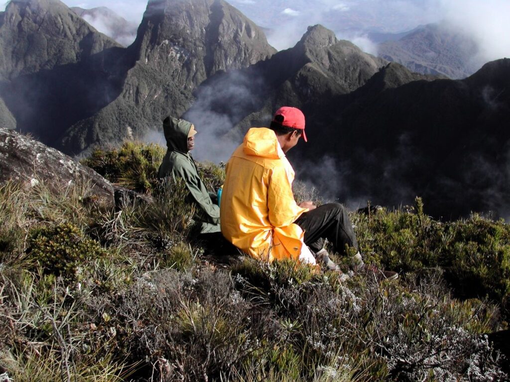
A very steep, slippery trail leads from Camp Simpona to the summit of Marojejy (elevation 2,132 m / 6,995 ft). High in the moorlands, often shrouded in clouds, this is another world, stunningly beautiful and different.
Camp Simpona
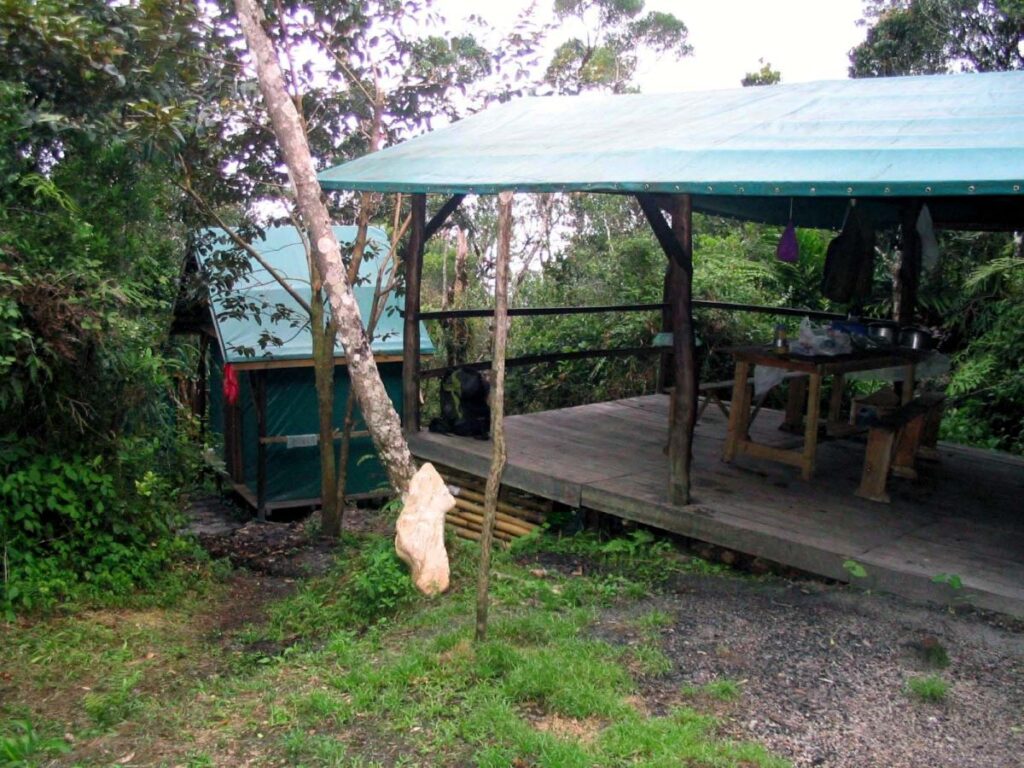
Located in the cloud forest at an elevation of 1,250 m (4,100 ft), Camp Simpona consists of a small, sheltered eating area and two cabins. There is also a small area to pitch tents. (Please note: as of 2025, the structures at Camp Simpona are unusable due to cyclone damage, but tent camping is still possible.)
Viewpoint (Belvedere)
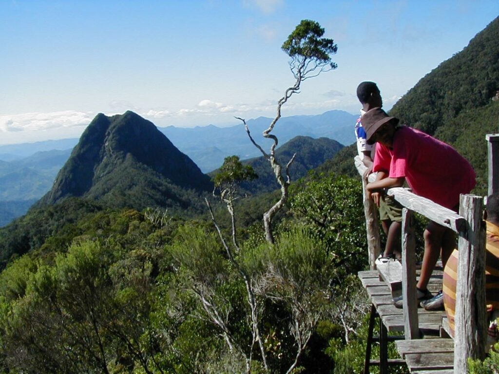
A wooden platform along the trail just below Camp Simpona provides stupendous views over the mountains and forests of Marojejy.
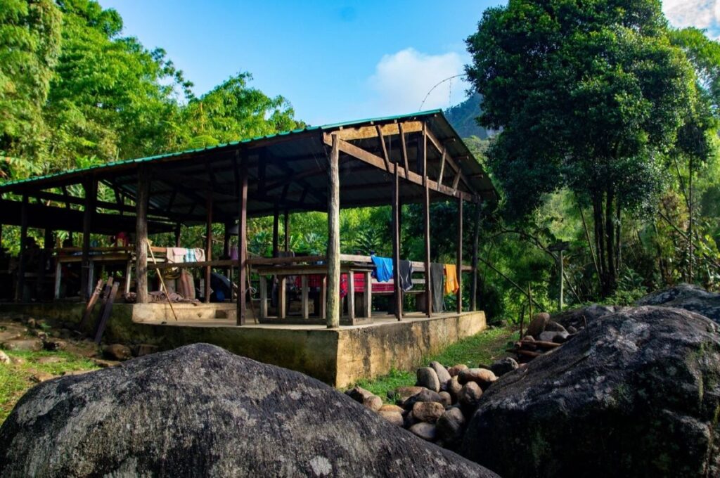
Camp Marojejia
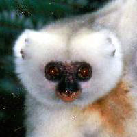
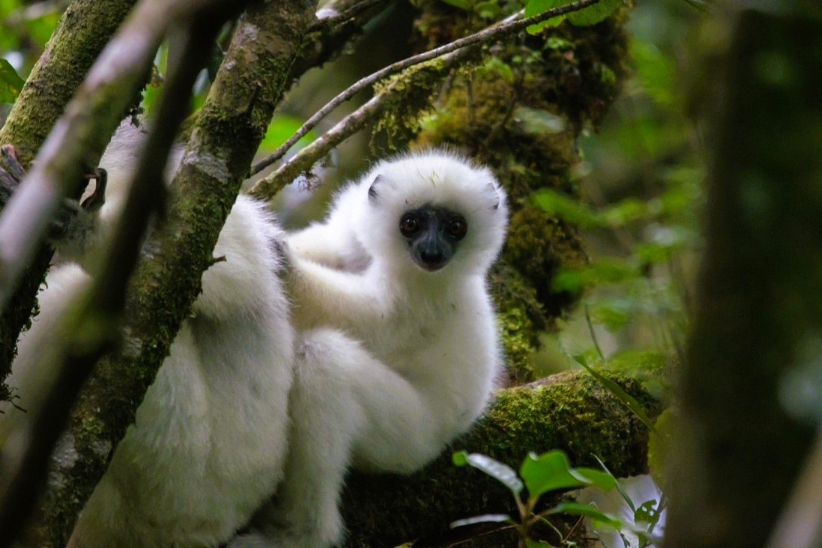
Camp Marojejia is perched on a hillside at an elevation of 775 m (2,540 ft) with stupendous views overlooking sheer granite outcrops and lush vegetation. The camp consists of a sheltered eating area and four cabins. There are also several campsites for tent camping. This area, at the transition between lowland and montane rainforest, is a good place to look for the beautiful and rare Silky Sifaka. (Photo courtesy of Louis Joxe Jaofeno.)
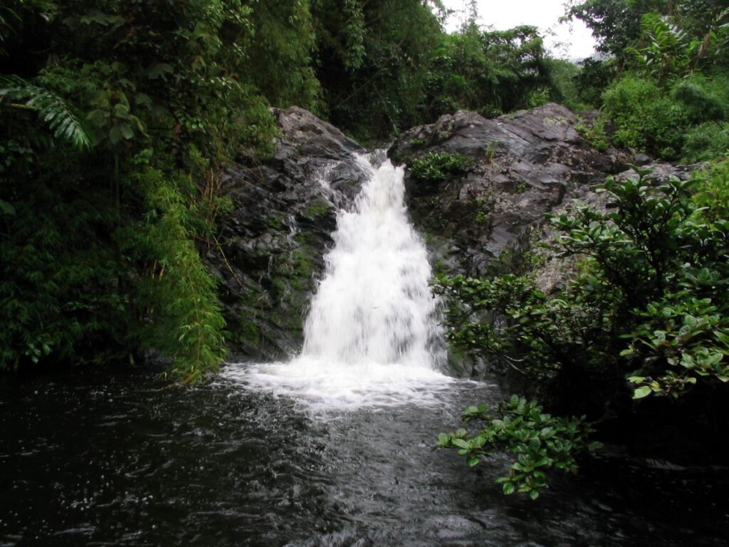
Cascade de Humbert
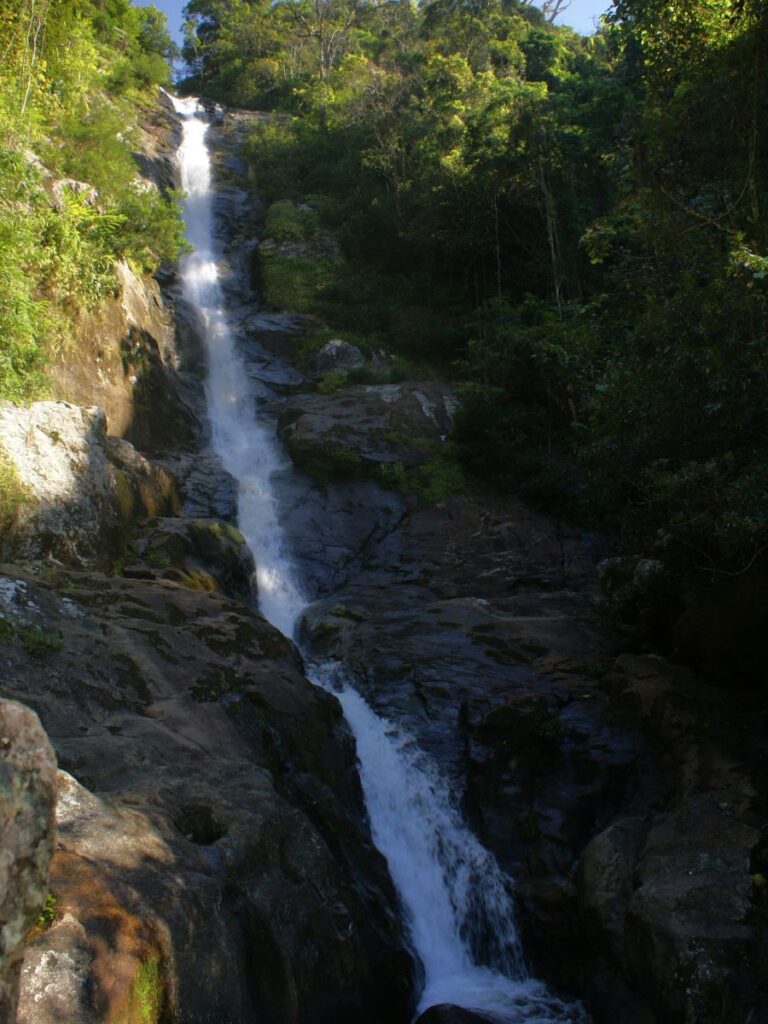
Only a short walk from Camp Mantella, this beautiful, cascading waterfall is surrounded by dense tropical vegetation. Two wooden overlooks provide views of the waterfall and out over the vast expanse of rainforest.
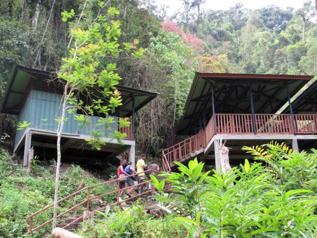
Camp Mantella
Tucked in a dense forest of bamboo at an elevation of 450 m (1,475 ft), Camp Mantella is a good place to see northern bamboo lemurs as well as the tiny frog the camp is named after. The camp has a large, sheltered eating area and six new cabins and ablution block. A campground is located nearby for those who prefer to pitch a tent.
Natural Pool (Piscine Naturelle)
A beautiful deep pool and small waterfall make this a refreshing stop along the trail on the way to Camp Mantella.
Park Entrance
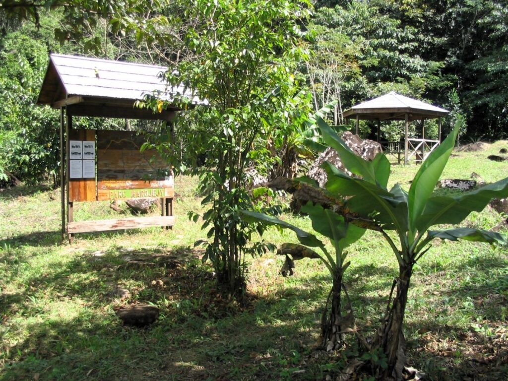
A bulletin board with map and a small, covered seating area mark the boundary where the trail enters the park. The change from the more open agricultural lands to the dense lowland rainforest is striking.
Mandena
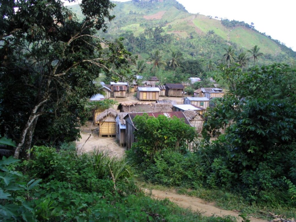
Located on the banks of the Manantenina River and only 3 km from the park boundary, the village of Mandena is the gateway to the park. Most of the residents here are subsistence farmers, growing rice and vanilla in the surrounding hills.
Manantenina
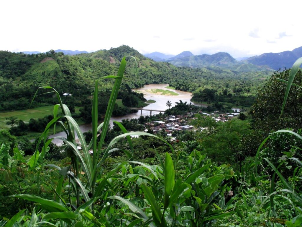
The village of Manantenina is located at the confluence of the Manantenina and Lokoho Rivers. It is on the main paved road between Sambava (65 km) and Andapa (40 km).
Marojejy Visitor Center
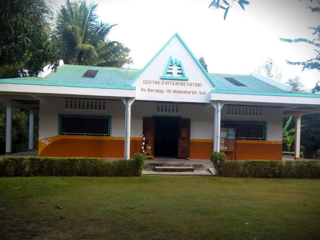
The Marojejy Visitor Center has a small exhibit hall with interpretive material and a kiosk. This is an essential first stop, where guides, porters, and cooks are arranged and fees are paid for treks into either Marojejy National Park or Anjanaharibe-Sud Special Reserve. (Photo courtesy of Ramanantena Fulsain.)
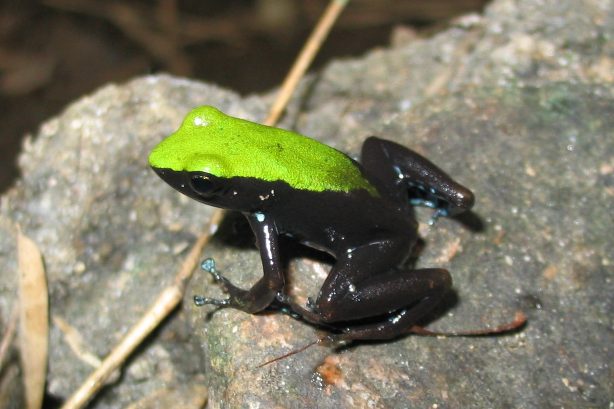
Mantella Trek
The Mantella Trek, named after the tiny frog shown in this photo, takes you to Camp Mantella, a four- or five-hour hike from Manantenina. Camp Mantella (elevation 450 m / 1,475 ft) has five cabins furnished with beds and mattresses. It also has a large, sheltered eating area with an assortment of cooking utensils. A campground is located nearby for those who prefer to pitch a tent. This area of lowland rainforest is a good place to see several species of lemurs, many birds (including the helmet vanga) and many species of amphibians and reptiles. The beautiful Cascade de Humbert waterfall is a short walk (800 m) from the camp. For best wildlife viewing, we recommend at least two days for this trek.
Simpona Trek
The Simpona Trek is a continuation of the Mantella Trek, leading from Camp Mantella up to Camp Marojejia (about a two-hour hike). Camp Marojejia is located at the transition between lowland and montane rainforest (elevation 775 m / 2,540 ft) and is perched on a hillside with stupendous views overlooking sheer granite outcrops and lush vegetation. The camp consists of a large, sheltered eating area and five cabins furnished with beds and mattresses. The name of this trek comes from the Malagasy name for the Silky Sifaka, a rare and beautiful white lemur found in this area. Plan on spending at least three days in the park for this trek.
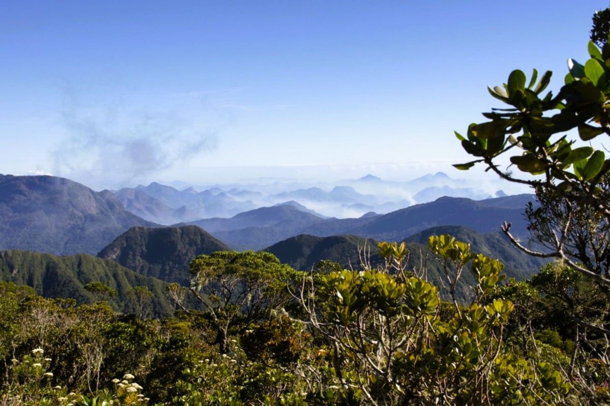
Marojejy Summit Trek
The Marojejy Summit Trek continues beyond Camp Marojejia along a very steep trail to Camp Simpona (elevation 1,250 m / 4,100 ft), which is then used as a basecamp for the final hike to the peak itself. Camp Simpona consists of a small camping area nestled high in the cloud forest. [Note: as of 2025, the cabins at Camp Simpona are no longer useable.] Trekking to the summit of Marojejy is a real wilderness experience — one of the most beautiful and wild adventures you will likely ever take. High in the alpine moorlands above the cloud forests, the views from the summit are truly spectacular. This rugged and difficult excursion requires a minimum of four days to complete.